Community Officials – Know Your Risk, Know Your Role, Take Action!
The New Jersey/New York coastal flood study will result in updated Flood Insurance Rate Maps (FIRMs), important tools that will provide a more accurate picture of flood risk in the region. You, as a community official, play an essential role in the map update process and in managing flood risk in your community.
Know Your Risk
New FIRMs are being developed to help you manage floodplain development in your community as a participant in the National Flood Insurance Program (NFIP), and to determine flood insurance rates and requirements.
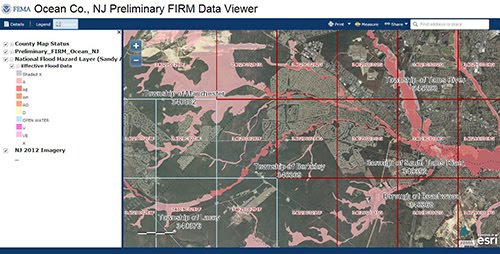
- Be sure to thoroughly review the preliminary FIRMs distributed to you by FEMA and understand the changes proposed. You can also view the maps online or download GIS data.
- Other flood risk tools designed to help you better understand and plan for flood risk in your community have also been developed. Learn more through the Flood Risk Tools page.
Know Your Role
As a community official, it is your responsibility to represent your community by actively engaging in the mapping process:
- Participate in FEMA-sponsored Resilience and Consultation Coordination Officer (CCO) meetings where you can provide input and ask questions about the preliminary FIRM, and discuss ways to reduce flood risk. A library of past meeting presentations is also available.
- Make sure your residents are aware of the new maps and tools they can use to understand and reduce their risk from flooding.
- Submit technical information to FEMA if you believe the flood hazard information on the preliminary FIRM is incorrect. It is also your responsibility to review and submit data to FEMA from other interested parties and indicate whether you support each appeal or comment. Learn more about the 90-day appeal period, and how, when and what to submit on the Appeals page.
- After the resolution of all appeals and finalization of the maps, your community must adopt or amend its floodplain management regulations to reference the new FIRM in order to remain compliant with NFIP regulations.
Take Action!

By being an active participant in the mapping process, you can make informed decisions about steps your community can take to prepare for and reduce flood risk:
- Use the new flood hazard information and flood risk tools to help with planning and mitigation efforts and to communicate more effectively with your residents.
- FEMA’s Mitigation Ideas publication also contains examples of how communities can reduce flood risk. State and local resources are also available to help.
- Adopt floodplain management standards above minimum NFIP requirements and join the Community Rating System (CRS). Your community will be more resilient to flood risk and flood insurance premiums for your residents will be reduced from 5 to 45% as a reward. Learn about steps your community can take to prepare to join.
Resources for Community Officials
See the Resources for Community Officials page for a complete list of resources.
- Frequently Asked Questions – Answers to frequently asked questions related to the coastal flood study, preliminary FIRMs, and more.
- Community Officials Events Calendar – Information on meetings to review the preliminary FIRMs and other events will be added as it becomes available.
- Document Library – List of materials featured on the Region II Coastal website, organized by topic.
Resources for Your Residents
See the Resources for Homeowners & Renters page for materials you can share with residents in your community.
Questions?
Contact us to find a subject matter expert who can assist you.

